




Services on Demand
Journal

Article
 English (pdf)
 Article in xml format
 Article references

 Automatic translation
 Send this article by e-mail
Indicators
Related links
-
 Cited by Google
-
 Similars in Google
Share

 Permalink

Tydskrif vir Letterkunde
On-line version ISSN 2309-9070Print version ISSN 0041-476X
Tydskr. letterkd. vol.62 n.3 Pretoria 2025
https://doi.org/10.17159/tl.v62i3.18837
RESEARCH ARTICLES
Landscape histories: Origin narratives and toponyms in the rural commune of Liboré, Niger
Sandra BornandI; Lawali DamboII
IResearch fellow at the CNRS (French National Centre for Scientific Research) in Villejuif, France. She is a linguistic anthropologist who has been working in Niger for 30 years. Email: sandra.bornand@cnrs.fr https://orcid.org/0009-0005-5291-2110
IIAssociate professor in the Department of Geography, Faculty of Arts at the University of Abdou Moumouni, Niamey, Niger. Email: lawali.dambo@uam.edu.ne https://orcid.org/0000-0002-6679-0311
ABSTRACT
In this article, we investigate how migration narratives, village founding stories, and place names shape the landscape and spatial memory of Liboré, a rural commune now located on the peri-urban area near Niger's capital. Drawing on fieldwork and an interactive map, we explore how these forms of oral discourse reflect and produce processes of anthropisation (physical transformation of the environment) and humanisation (the assignment of meaning and value to places). Migration stories recount the symbolic and practical logic of settlement, while founding narratives describe how hostile environments-dense bush, spirits, floods, or drought-are made liveable through clearing, adaptation, and negotiation with non-human forces. These stories embed crisis, displacement, and resilience into collective memory. Toponyms act as micro-narratives that capture environmental features, historical traumas, and social structures. Some commemorate ancestors or ecological traits; others encode memories of slavery, forced labour, or colonial extraction. Place-naming emerges as a performative act that reconfigures relationships to land and power. By weaving together narrative and spatial analysis, we show how the communities of Liboré continuously reshape their territory through stories, names, and memories. These practices not only document transformation-they enact it, revealing how naming and narratives are central to processes of territorial claim, identity formation, and environmental perception.
Keywords: anthropisation, human, humanisation, non-human, orality, narrative, Niger, space, toponyms, Zarma.
Introduction
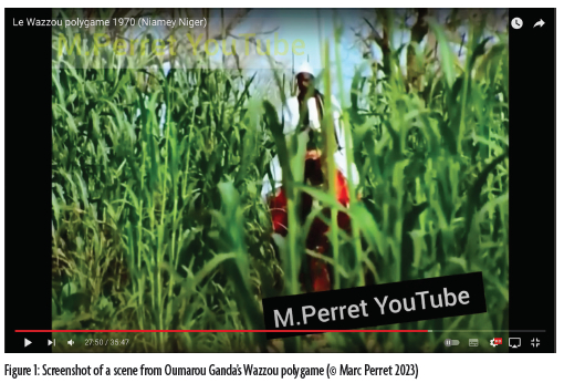
Watching the 1970 film by Nigerien director Oumarou Ganda, Wazzou polygame (Wazzou the polygamist), we were struck by the tall millet growing in Liboré. It's a stark contrast to what we observed on regular visits since 1994.1 We recalled the popular etymology of the toponym "Liboore". This toponym is composed of the Fulani term lubbo, referring to a grass called Cymbopogon schoenanthus proximus, and of the Zarma postposition ra (in). We were also reminded of the myth about the discovery of the region by an ox. After finding it to his liking, his owner settled on the land around the 18th century.
What, then, do the stories of migration, of the foundation of villages and hamlets, and the toponyms associated with them, which can be considered micro-narratives (Calame), tell us about the anthropisation and humanisation of space? What memories do they evoke? To address these questions, we will analyse, from the two perspectives of linguistic anthropology and geography, the different discourses produced within these three discursive genres. We draw on anthropological research on naming (Leguy) and on toponyms (Basso; Webster), as well as a geographical approach that focuses on language (Tuan; Collignon).
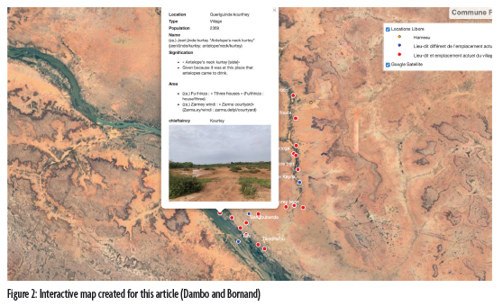
In this study, we explore how migration narratives, village and hamlet founding stories, and toponyms shape the territorialisation of Liboré. The narratives recorded in 1996 and 1998 were gathered by Sandra Bornand during fieldwork conducted as part of her doctoral dissertation at the University of Lausanne, Lausanne, Switzerland (published in 2005 as Le discours du griot généalogiste chez les Zarma du Niger). Through this research, she aimed to gain a deeper understanding of a particular ancestor's narrative as recounted by Jeliba Baaje, a jasare (Zarma historian-griot), narrated during weddings and in face-to-face frameworks. The narratives recorded in 2023 were collected by Abdourahamane Hamani, who lives in Mallaley (Liboré), as Bornand was not authorised by the CNRS to travel outside of Niamey due to security concerns. These recordings were carried out in the context of International Society for the Oral Literatures of Africa (ISOLA)'s call for contributions and were aimed at producing an interactive map in English, intended for use by the municipality and the canton chief of Liboré. The project seeks to make spatialised oral knowledge accessible and usable by local authorities and the wider community.
In the first section of the article, we introduce the geographical, climatic, and historical context of the rural commune of Liboré, linking it to migration and landscape transformations. In the second section, we examine Zarma migration narratives and village and hamlet founding stories, illustrating how environmental adaptation turns untamed land into meaningful space. In the third section, we analyse toponyms as micro-narratives, uncovering the complex relationships between humans, animals, spirits, and the environment. In the fourth section, we discuss how naming processes structure space and influence territorial perceptions and social organization. In the conclusion, we synthetise how narratives and naming practices reflect different worldviews, shaping memory, identity, and spatial organisation. An interactive map visualises this spatialised collective memory (Dambo and Bornand).
The rural commune of Liboré
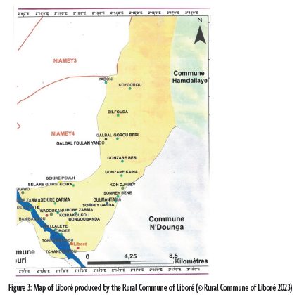
Liboré is both a rural commune and a canton. In Niger, a rural commune is an administrative unit that includes villages, hamlets, or neighbourhoods, sometimes overlapping with a canton, depending on regional and environmental factors (République du Niger). Located within the Kollo department in the Tillabéri region, Liboré lies along the Niger River and borders Niamey to the north and the rural communes of N'Dounga and Hamdallaye to the south and east. It has a semi-arid Sahelian climate with an average annual temperature of 30°C. It receives an average of 500mm of rainfall per year and is marked by torrential and irregular rains (Bahari Ibrahim and Faran Maiga).
Following the 2001 decentralisation policies, Liboré was expected to join the Urban Commune of Niamey (CUN). However, its inhabitants resisted and chose to remain within the Kollo district, which was upgraded to a department (Motcho), leading to Liboré's designation as a rural commune. This decision led to a territorial dispute over three villages (Ballare Guirssi Koira, Koubome, and Sekire Peulh) that are officially part of Niamey but claimed by Liboré.2 As of 2023, Liboré covers 110 km2 and includes twenty-four administrative villages and five hamlets. It is mainly inhabited by Zarma people. Leadership is divided among Zarma (20 villages, two hamlets). Two villages are administered by Kurtey chiefs, two villages and hamlets are administered by Fulani chiefs, and one hamlet is co-administered by both Zarma and Fulani chiefs.
Located near the capital along the Niger River, Liboré's population has more than doubled in sixteen years, particularly in riverside villages and those bordering Niamey (272 h./km2 in 2006; 571.6 h./km2 in 2022) (Commune rurale de Liboré). Rapid urban expansion and unregistered land acquisition under the 1993 Rural Code have led to housing encroaching on agricultural land. This has intensified land degradation, exacerbating soil degradation and erosion on sparsely vegetated slopes.
At the same time, environmental changes driven by human activity and climate variability have significantly altered the landscape (Abdoussalami et al.). Increased erosion, gully formation, pond sedimentation, crusting on cultivated surfaces, and sand deposition on certain infrastructures reflect the ecological imbalances affecting riverside localities like Liboré, which are subject to current fluvial dynamics (Bahari Ibrahim and Faran Maiga).
The following section explores how migration stories, founding narratives, and toponyms collectively express how communities in Liboré inhabit, name, and remember their environment while evoking past and present transformations and articulating symbolic claims to territory.
Narrating the land: Migration, founding narratives, and toponyms
The migration narratives and founding stories in Liboré provide insights into how communities remember and narrate their relationship with the environment. These narratives reveal how humans negotiate their identity and survival within specific spaces, while simultaneously transforming them. In this section, we first examine migration narratives, which recount the movement of people and the circumstances of their arrival. We then turn to founding stories, which describe how settlers adapted to a challenging environment, cleared land, and established settlements. Finally, we explore toponymic narrative and place names as micro-narratives (Calame), revealing how these names encapsulate collective memory and territorial appropriation.
In this section, we investigate how these narratives serve as tools of spatial memory, landscape transformation, and symbolic claims to territory. We begin by looking at migration narratives, which symbolically explain how the Zarma first arrived and settled in the area. These stories emphasise both divine guidance and ecological pragmatism in choosing the land. Founding stories, in contrast, tend to depict the land as hostile and untamed, requiring physical and symbolic transformation to become inhabitable.
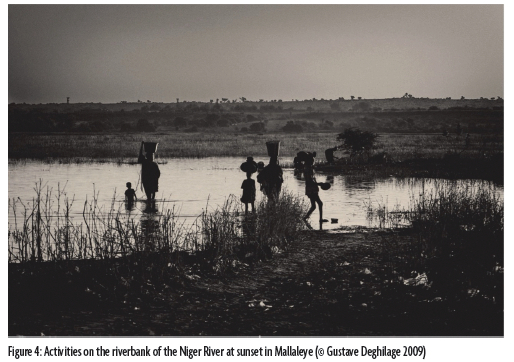
According to jasare, Maali Beero-the ancestor of the Zarma aristocracy-and his companions left Mallé (in present-day Mali) following a conflict with the Tuaregs and/or Fulani, many of whom were killed by the jasare Jeliba Baaje (Bornand, Le discours du griot généalogiste chez les Zarma du Niger; "'Entre ciel et terre'. De la construction de l'espace à la construction d'une identité collective dans dois récits d'origine des Zarma (Niger)"; Mounkaïla). Fearing retaliation, they fled aboard a daba (a flying granary bottom) to Sargane in the Zarmaganda. The rest followed on foot, guided by fresh roselle shoots (Hibiscus sabdariffa) sprouting from seeds scattered from the sky. After Maali Beero's death in Sargane, they moved southwest and settled near a kokorbe (Combretum glutinosum) tree, naming the village Kogori after it. Historian Boubé Gado (174) links the name to: "baobab seed, fruit of the baobab tree [Adansonia digitata]".
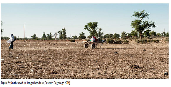
The arrival at the riverbank and what would later become Liboré was recounted to us by various interlocutors (burcin, who are freeborn men, and jasare). Here is O. M.'s version, recorded in 1996:
The Kogori came from Fakara to settle here, seeking a place by the river. During the rainy season, they caught a black ox, their totem, and loaded it with a perforated sack of roselle seeds. They sent the animal to find a suitable spot. As it moved, seeds fell one by one. It grazed by the river during the day and returned to rest. When the ox did not return, the Zarma sent a Fulani to find it. Following the sprouted roselle, he saw the ox and informed the Zarma. Upon arrival, they found the animal lying down and declared that he had chosen the place for them.
This reveals a symbiotic relationship between humans and animals. Another informant specified that the leader of the migration was killed on the road by the Tuaregs, and his two brothers later settled by the river.
The myth of the Zarma's arrival in present-day Niger and of the discovery of Liboré encapsulates themes of migration, survival, and resilience. Central to these narratives is the role of the symbolic markers-such as the roselle seeds that guided the journey and the ox that "chose" the settlement site. Those elements, while seemingly mythical, also reflect practical considerations concerning water, vegetation, and topographical suitability for settlement.
For instance, the roselle seeds are not only symbolic of life and nourishment but also serve as a marker of continuity, connecting the migrants' past to their future. The ox's role in selecting Liboré further embodies a symbiotic relationship between humans and animals, which resonates in subsequent narratives about the Zarma's relationship with non-human agents in the landscape.
By recounting these stories, communities anchor their identity in the landscape, transforming the land from an uninhabited "wild" space into a humanized, meaningful territory. This resonates with Keith Basso's idea of naming and storytelling as acts of world-making, where names and narratives spatialise collective memory.
While the discovery narratives portray this area as hospitable despite attacks by Tuaregs, the founding stories of villages and hamlets often contrast by describing the landscape as hostile and untamed. The founding narratives depict a land dominated by deep bush (saaji bi, black bush), wild animals, spirits (ganji, tooru), or devils (saytaan), presenting a world that settlers had to actively transform to make it habitable.3
These narratives detail the early settlers' efforts to adapt and transform a challenging environment, shaped by physical threats, environmental extremes, and liminal boundaries. For example:
-
Hostility of the landscape:
-
"No one dared come from Gueriguinde to farm, because it was the bush. In the past, people feared the spirits" (inhabitant from Fandoga, 2023).
-
"Our ancestors were hunters. They settled in the place. At that time there were hyenas, foxes, spirits" (inhabitant from Gonzaré Kayna, 2023).
-
"The father-in-law of Tafa Mace advised him to always stay in Korozey because elsewhere hyenas prowled. Tafa Mace replied that he feared neither human hyenas (boro kooro) nor animal hyenas (alman kooro)" (inhabitant from Bangoubanda, 1998).
-
-
Environmental challenges: The terrain posed additional challenges, such as swampy areas where cattle and humans struggled to navigate, or water that was either too scarce or too abundant.
-
"A thirsty warrior had to wait for Bilfouda to be able to drink and wash" (inhabitant from Bilfouda, 2023).
-
"When they went to cultivate in their farming village, they had to perform dry ablutions at prayer time for lack of water" (inhabitant from Oulmantama, 2023).
-
"The Fulani shepherds used to shout about: 'Ya boni [O misfortune!)', when their cattle got stuck" (inhabitant from Yaboni, 2023).
-
"Gadoh's inhabitants came from Abda Goungou, where they owned many animals, but as the herds grew, they could no longer live on the island because, during the rainy season, water surrounded it entirely" (inhabitant from Gadoh, 2023).
-
In some villages, founding stories reflect a liminal understanding of the landscape, where the boundary between human and non-human worlds was blurred. Settlers were often depicted as negotiating with spirits or forces inhabiting the land. For instance:
-
"At that time, only the inhabitants of Banigoungou lived here; some say they are descendants of spirits (ganji). Back then, whenever the Tuaregs tried to attack them, they always managed to make the village disappear" (inhabitant from Tonkobangou, 1996). And, "It is said that the people of Banigoungou used to have a sort of talisman to prevent anyone from seeing them" (inhabitant from Bangoubanda, 1998). The first inhabitants of Banigoungou and their descendants are said to be "half-spirits, half-humans", embodying a threshold between two realms. Their coexistence with non-human forces required negotiation and adaptation to make the land habitable.
-
Similarly, in Gonzaré, early hunters were seen as "masters of the bush and allies of the spirits that inhabit it" (Olivier de Sardan, Concepts et conceptions songhay-zarma : histoire, culture, sociétés 167, our translation). However, their liminal identity as mediators between humans and non-humans led to social tensions. As one local recounts: "They were told: 'a hunter cannot live among others, he must live in the bush'. That is how they eventually relocated here, in Gonzaré Kayna" (inhabitant from Gonzaré Kayna, 2023).
These stories illustrate how the transformation of space often required settlers to engage with non-human forces.
A central aspect of anthropisation in Liboré is the clearing, deforestation, and taming of wildlife to establish settlements. These transformations are evident in stories such as:
-
"Upon arriving here, the people of Kogori immediately began clearing the land to settle in the area" (inhabitant from Tonkobangou, 1996).
-
"They settled places inhabited by hyenas, foxes, and spirits, clearing the bush to make the land usable" (inhabitant from Gonzaré Kayna, 2023).
-
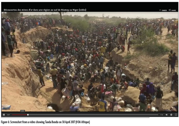
"When we arrived, the area was a dense forest with species like Mitragyna inermis (African corkwood tree), Acacia nilotica (gum Arabic tree), and others. It became a protected zone where tree-cutting was prohibited. Later, permission was granted to clear the land, and the people from Gueriguinde and Banigoungou repeatedly felled trees at the place they called 'Tanda Bundu'" (inhabitant of Tanda Bundu, 2023).
These stories highlight how physical transformation-such as the deforestation of Tanda Bundu (which signifies wood for hangar)-was accompanied by symbolic appropriation, as spaces became associated with cultural and collective meaning.
The memory of crises is a recurring theme in founding stories, highlighting the settlers' struggles to transform a hostile landscape into a habitable territory. Epidemics, droughts, famines, and water-sometimes too little, sometimes too much-are deeply ingrained in local memory, shaping both livelihoods and environmental perceptions.
-
Food, famine, and displacement: In Tilbi, master fishermen (sorko), followed by Bambara settlers, attempted to establish a community but were forced to relocate after devastating floods, highlighting the dual nature of water as a resource and a threat. Similarly, an inhabitant from Fandoga (2023) described the "Year of the Gari" (garo jiiri), named after cassava semolina or flour (1952-1953), when heavy rains flooded the low-lying settlement, forcing residents to relocate: "The inhabitants of Fandoga, who had settled in a hole, had to climb the hill to avoid being threatened by the heavy rains". Famine also prompted migration. An inhabitant from Gonzaré-the-Big (2023) recalled: "They had gone south. [...]. When the famine ended, they came back".
-
Epidemics and resilience: An inhabitant of Bangoubanda recounted the displacement of the village because of epidemics: God brought a great misfortune, an epidemic. People were dying one after another. It became impossible even to visit the sick, nor were condolences offered any longer. One day, slaves, whom God had endowed with wisdom, suggested that the women gather their belongings and move a bit further. A new village was constructed, identical to the first one. The people relocated, and God made the disease vanish. God brought an end to [the] epidemic and death". (inhabitant from Bangoubanda, 2023)
These narratives of crises reflect the delicate balance settlers had to maintain in adapting to and reshaping their environment. The dual role of natural forces-both as essential resources and existential threats-underscores the complexity of inhabiting these spaces. By embedding these crises in their collective memory, communities not only preserve the lessons of resilience but also maintain a deep connection to the land and its history.
The founding stories of villages and hamlets in Liboré recount a dual process of transformation: anthropisation, defined by Jacques Lévy and Michel Lussault as "a modification of geographical environments through human action, studied from a physical and biological perspective", while humanisation "presupposes a phenomenological perspective in which the value and meaning of the environment for human beings are considered" (Lévy and Lussault 86, our translation).
In Liboré, anthropisation is evident in the land clearing and deforestation, the taming of wildlife, and the establishment of villages or hamlets, leading, for instance, to the complete disappearance of a forest (for example, the forest which gave the name Tanda Bundu disappeared). These transformations were often accompanied by violence and exploitation. In the precolonial era, conflicts over land and resources led to displacement and enslavement. In the colonial era, villagers were forced to leave the riverside where they lived and settle on the hill near the military company in order to work for it, with wells quickly drying up due to high water demand and famine. According to a colonial report from 1945, "[...] the village of Liboré was supposedly relocated during the construction of the road from Niamey to Kollo around 1911/1913" (Berger, our translation).
The colonizers had asked our village to move and settle in the district of the canton chief at that time. We protested, arguing that we did not share the same ancestor [...]. The chief immediately went to inform the French commander of our refusal. The commander summoned everyone and took out some matches, probably due to light a cigarette. [...]. He told the population that if they did not move by the next day, all the huts found would be burned. This order petrified everyone because he was displacing people living by a watercourse to settle them next to a well. It was truly a hardship considering the effort required to get water". (inhabitant from Tonkobangou, 1996)
The founding stories of Liboré reveal how the first settlers transformed a landscape perceived as hostile into a habitable territory, engaging in both anthropisation and humanisation. Through land clearing, taming wildlife, and negotiating with spirits, they reshaped ecosystems to suit human needs while simultaneously embedding cultural and symbolic meaning into the environment. These narratives-shaped by crises, liminality, and adaptation-demonstrate how storytelling itself serves as an act of territorial appropriation and world-making. By recounting the struggles of settlement and the relocation, the people of Liboré not only document a history of transformation but also construct a shared memory that anchors their identity in the land, reinforcing the interconnectedness of humans, non-human forces, and the landscapes they inhabit.
Many toponyms describe vegetation, water sources, or animal behaviour, offering insights into how the environment shaped settlement patterns and resource use. Other names reflect historical memory-slavery, forced labour, epidemics-and continue to mark social hierarchies and power structures.
The naming of places is a powerful act of spatial appropriation. Toponyms do more than serve as geographical markers; they encapsulate collective memory, mark human engagement with land, and serve as sites of identity formation. By naming a place, communities organise and structure the environment, making it familiar, meaningful, and habitable. Unlike founding narratives, which describe the challenges of adapting to and transforming their environment, toponyms function as micro-narratives, encoding experiences and symbolic perceptions of space.
As Béatrice Collignon has demonstrated, toponyms constitute dense repositories of spatial knowledge and collective memory. Far from being mere geographical designations, they function as mnemonic devices through which histories, experiences, and social relations to the land are transmitted and reactivated. In this perspective, and following Carlo Severi's reflections on the symbolic and memorial functions of proper names, toponyms can be understood as bundles of meaning-condensations of lived experience that operate as triggers of remembrance. The act of naming, therefore, exceeds its descriptive function: it is an act of territorial inscription, a way of materialising social relations to space. As Marion Ségaud (70 our translation) aptly notes, naming a place means "tracing a relationship with the territory [in a given space and time] by attributing qualities to it that allow everyone to identify with it".
Through place names, communities narrate their experience of the land, embedding their interactions with humans, animals, and spirits in the landscape. This aligns with Basso's concept of place-making, which highlights how names structure space, linking geography with memory, emotion, and identity. The study of toponyms, therefore, reveals a process of humanisation, where names transform unfamiliar, dangerous, or contested territories into spaces imbued with meaning and social significance. This process of naming reflects broader cultural exchanges, as certain toponyms integrate words of Fulfulde, Arabic, or Hausa origin, attesting to the historical interactions between different communities.
Toponyms as micro-narratives of the environment
Toponyms serve as micro-narratives of space, memory, and human experience. Many of them describe elements of the natural environment-vegetation, water sources, or animal behaviour-offering insight into how ecological features have shaped settlement patterns, resource use, and spatial organisation. These names reflect how communities navigated, interacted with, and interpreted their surroundings through the lens of lived experience.
Names such as Garbay-ɲa (Desert Date Palms, Balanites oegyptiana), Ko boŋ tafa (the baobab with wide foliage, Adansonia digitata), Kosay (Camel's Foot, Piliostigma reticulatum), Kuubo me (Fear the Firethorn Bushes, Pyracanta coccinea), and Se cire (Under the African Hackberry, Celtis integrifolia) underscore the deep relationship between people and local flora. Others, such as Baani gungu (island of peace, indicating also a refuge), Bangu banda (behind the pond), Fimbaare (a piece of land delineated by the meandering of a watercourse), and Gooru beeri (large river) draw from hydrological landmarks to mark zones of refuge or boundaries. Wildlife also figures prominently, with Jeeri jinde (antelope's neck, where antelopes used to come to drink) and Tobay gulla (hare's burrow), recalling the presence of fauna in specific areas. Further toponyms encode rural life, agricultural practices, and pastoral activities, reflecting the daily routines and economic foundations of cultivators and herders. Place names often encode gendered dimensions of rural labour, offering spatial testimony to the division of tasks between men and women. Toponyms such as Duubay (threshing floor) refer to communal spaces where women transformed harvested millet by threshing it to separate the grain from the chaff-a key stage in cereal processing. Tonko bangu (chili pepper pond) designates areas where women cultivated chili peppers, highlighting their role in small-scale farming and market gardening. In contrast, herding and animal care-typically carried out by men-is reflected in names like Ga do (near the livestock pen) and Ballaare Jirsi kwaara (at Jirsi house among the cow dung), which mark spaces associated with cattle. Galbal, derived from the Fulani word galbe (livestock brought to market), commonly refers in the Fulani context to an enclosure near the market, where animals are kept before being sold. In Liboré, however, Galbal designates an enclosure used to group livestock that are intended for sale, but located before the market, both spatially and functionally. It operates as a preparatory space-where livestock are held prior to being taken to the market-highlighting a state in the pastoral economy that precedes the actual transaction. This variation reflects how toponyms adapt to local practices while maintaining their broader semantic origins. Candi faaru (knife sharpening) is so named because of people who used to come here to sharpen knives before cutting the grass for their animals. Other toponyms, such as Bakin kasuwa (at the entry of the market or near the market) and Bukkayzey do (near the small huts), point to the economic and domestic micro-spaces surrounding local trade and daily life.
The mineral world or the type of soil is also reflected in naming practices. Kormoto is named after the presence of red sedimentary rock (variegated clay). Tilbi (to get stuck in the mud) was named after the Kurtey (Songhay-speaking Fulani), the first occupants of the site, who got stuck in the silt (botogo) while trying to reach the site during the dry season.
In addition to soil and geological composition, toponyms help define and structure inhabited spaces by providing directional references, establishing relative positioning and describing topographical features. Sooray beene (upper sorey) and Sooray ganda (lower sorey) indicate the relative positioning of two villages with the same name. Posto boŋ (near the checkpoint) marks a historical checkpoint where motorists once paid to enter Liboré. Kwaara kuuku (long village) was named by colonial administrators who found the village unusually elongated, reflecting an external gaze imposed on local geography.
Some toponyms reflect topographical features, offering cues about elevation, slope, or proximity to natural landforms. These names provide inhabitants with spatial orientation and help describe the physical landscape in lived terms. Toponyms such as Fando boŋ (top of the high ground) and Plateau (from French) refer to similar topographical features-namely, elevated landforms or flat highlands. While Fando boŋ is a local term anchored in indigenous spatial language, Plateau reflects a more administrative or colonial designation. Both, however, describe the neighbourhoods' location on raised terrain and function as orientation markers within the landscape. Ganda ce (those along the riverbank) captures the positioning of a settlement close to the river. Kominak guuso do (near the Cominak pit) evokes industrial or extractive features that reshape topography. The name refers to a pit resembling human-made mines, associated with the activities of Cominak, a mining company in Niger specialising in uranium extraction. The toponym Kominak guuso do does not signify an actual Cominak company presence at the site; rather, it reflects local perceptions that this place's features resemble the deep mining pits operated by Cominak elsewhere in Niger. Such metaphorical naming highlights how community toponyms are guided by perceived analogies and symbolic references, emphasising perception and metaphor in naming practices without implying any literal corporate involvement. This organisation of toponyms aligns with Basso's (1996) view that naming places helps people orient themselves and structure their lived environment.
Beyond physical features and spatial orientation, toponyms also encode historical memory, social meaning, and symbolic associations. They serve as narrative anchors that reflect past events, spiritual beliefs, and human experiences that transcend the material landscape. The primary function of toponyms is not simply to mark space. For instance, the disappearance of the mango tree, baobabs, or antelopes did not prompt a change in names. Similarly, when the village of Tilbi relocated around 1904 due to flooding, it left the island that gave it its name: from the Zarma, tibi, to get stuck in the mud. Even after moving away from the river to higher ground, the name remained unchanged.
This suggests that villages, hamlets, and neighbourhoods are named not just for spatial orientation, but rather to encapsulate the human experiences and histories tied to the land. These toponyms reflect the humanisation of space, although some toponyms also refer to dangers or supernatural beings. For example, Mallalay, which originates from a refrain sung by two spirits that used to drink from a pond near the Niger River, signifies a space once dominated by supernatural entities before being appropriated by humans. Similarly, Ya boni (O misfortune), was an exclamation frequently shouted by the Fulani herders when their cattle got stuck in the swampy terrain, serving as a spatial marker of physical danger posed by stagnant water. Waadu ka (spared from fatality) reflects the successful avoidance of anticipated tensions by some residents, who relocated to a safer area and named their new neighbourhood to mark their escape but also to remind people of the conflict they avoided.
Beyond environmental and symbolic references, some place names are shaped by individuals who left their mark on the land. These toponyms preserve the memory of founders and historical figures, embedding personal legacy into the geography. Some villages, hamlets, or neighbourhoods have taken the name of their founder. For instance, the village of Korozey is named after the warrior Korozay, who arrived among the first settlers in the region. Similarly, there is Barji kuray (Barji neighbourhood) and Jama (nickname), both named after their respective founders. Other examples include Tanja kwaara (at Tandja's home), named after Tandja, a former president of Niger who resided in this neighbourhood, and Gado kwaara (at Gado's place; nickname/home), named after Gado. These names anchor places in collective memory, celebrating individuals whose legacies live on the land and who played key roles in the establishment and transformation of their communities.
While toponyms derived from founders anchor locations in collective memory, others go beyond individual figures to reflect the social, cultural, and religious structuring of space. These names illustrate how communities, in settling the land, have marked and shaped the environment, strengthening the connections between groups and the landscape. Some toponyms reflect territorialisation based on social lineage or leadership roles, indicating groups that historically held chieftaincy or had a significant presence in the village, hamlets, or neighbourhoods.
-
Sekire Zarma/Sekire Peulh and the Golle neighbourhood in Tonkobangou, for example: These names mark the spatial distribution of groups, particularly the Zarma and Fulani, within local chieftaincies.
-
Zarmey Windi (Zarma compound): A name explicitly associating a space with a particular group, reinforcing the link between social organisation and settlement patterns.
One toponym reflects social gathering spaces and communal interactions:
-
Koira Lami, from the Zarma expression kwaara laami (desire of the village): This name refers to a historical gathering place, where people from surrounding villages assembled, shaping the communal structure of the area. It was the initial settlement of Korozay, the founder of the village of Korozey, before he relocated to his current location on the riverbank. The name reflects its historical significance as a social hub.
Religious identity and environmental constraints are also inscribed in toponymy:
-
Oulmatantama: This name originates from the phrase Iri ma tama in Zarma (let's perform dry ablutions), a practice (tayammum) used when water is scarce. The word tama is derived from Arabic tayammum, transmitted via Fulfulde (taamaade, performing ablutions with sand). This toponym highlights both religious practice and environmental adaptation, as it reflects the scarcity of water in the region.
While the previous toponyms anchor places in specific social, cultural, and religious identities, the following ones reflect power struggles, historical conflicts, and enduring social hierarchies. The structuring of the space was influenced not only by 'ethnic' groups and religious practices but also by territorial struggles and power relations that became embedded in collective memory. These toponyms bear the imprint of confrontation, resistance, and social reorganisation that defined precolonial history:
-
Dabay (slave quarter) refers to the historical social order in the precolonial period, an order that persisted through the colonial era and continues to exert an underlying influence today. The term originally designated a neighbourhood inhabited by enslaved individuals (baɲɲa) and their descendants, attached to a village populated by freeborn people (burcin). Over time, however, the name has been replaced by a euphemism Mango do (near the mango tree) to avoid the stigma associated with slavery. The renaming reflects broader social dynamics, illustrating how communities navigate historical memory and shifts in social hierarchies. The transition from Dabay to Mango do underscores a process of reframing history through place names, adapting to contemporary social sensibilities. However, all natives of Liboré still know that the original name of the neighbourhood was Dabay, and its historical significance remains deeply embedded in local memory.
-
Like Dabay, the toponym Zamey do (near the blacksmiths) reflects a precolonial social hierarchy. Blacksmiths (sg. zam) were historically classified as enslaved individuals who became specialised artisans, holding an ambivalent status as both essential and marginalised. While they played a crucial role in society by crafting tools, weapons, etc.-mastering fire and the secret of the forge-they were often excluded from political power, were feared, and subjected to social stigma. The presence of a designated neighbourhood for blacksmiths highlights how precolonial spatial organisation was shaped by the notions of social group and occupation. Though official segregation has disappeared, the historical association persists through place names, demonstrating how toponyms preserve the memory of past social structures.
-
While many migration narratives and founding stories encode the memory of precolonial conflicts, only one toponym does it: Sorey. Oral traditions directly link it to Tuareg raids (razziya) against Zarma, marked by the capture of livestock and people, widespread displacement, and resistance. One oral narrative, recorded in 2023, recounts the events that gave the village its name: The Tuaregs waged wars, traversing through the Zarma regions, engaging in raids and abductions. [...]. According to elders, one of the ancestors of the people here, the grandfather of Yansambu, known as Kumbulu, was the first to settle in this valley and was a hunter. One day, while drawing water, he heard voices-some on camels, others on horses. [...]. Seeing the clothes he had taken off and hung up, they realized someone was there and drove the animals towards him. Realizing he had been discovered, he took his bow and arrows and withdrew into the marsh. As the attackers advanced, he shot down two men with poisoned arrows, forcing other to flee. Before escaping, they cried out "Sooray, sooray, sooray" (diarrhea), giving the village its name. (inhabitant from Sorey, 2023)
The naming of Sorey thus encodes the history of resistance against precolonial warfare and enslavement, transforming a moment of violence into a territorial marker. Like Dabay, which reflects the legacy of slavery, Sorey serves as a spatialised memory of historical conflict. This toponymic narrative suggests multiple possible interpretations:
1. Historical trauma and resistance: The naming of Sorey encodes the memory of resistance against precolonial warfare and enslavement, transforming a moment of violence into a territorial marker.
2. Multiple layers of meaning: Like Dabay, which reflects the legacy of slavery, Sorey functions as a spatialised memory of historical conflict, encoding the long-standing struggles over territory, freedom, and survival.
3. Linguistic ambiguity and discursive reframing: The Zarma meaning of Sooray (diarrhea) introduces another layer of interpretation. If this term was indeed attributed to the Tuareg attackers, it could reflect a discursive strategy-assigning panic and disorder to them in a way that diminishes their power and reframes the memory of the event. This suggests how naming-and the act of explaining names-is not merely a passive record of history but an active process of reinterpreting and reappropriating conflict through language. Together, Dabay and Sorey illustrate how toponyms serve as sites of historical inscription, preserving the collective memory of precolonial struggles, shifting power relations, and the resilience of the communities that inhabit them.
The colonial period also left its imprint on place names, often through references to forced labour, economic extraction, and strategic displacement. These toponyms encode the memory of constraint, subjugation, and resistance, and reflect the profound transformations brought about by colonialism-particularly through three pillars of colonial exploitation: forced labour, military conscription, and taxation.
-
Trawo, derived from French "travaux", refers to a site where forced labourers were gathered. An inhabitant from Tonkobangou (1996) describes this period: At the time, people were told to inform the chief to bring a hundred people for forced labour. These hundred people were caught and brought to the site. After a month, they had to return and were replaced by a hundred new people. [...]. They had to level the roads and build houses with no equipment-no cars, no Caterpillars. [...]. They built the roads from here to Gaya, from here to Zinder, and from here to the present-day Burkina Faso. For everything, they carried the sand on their heads. The sand was put into baskets with a shovel. You loaded it while running, chased with a stick. You. Before arriving, most of the sand had spilled. [...]. Only gravel remained, which was poured onto the road. They had to collect it from a hundred to two hundred meters away. Sometimes the distance was a hundred meters, sometimes a hundred and fifty. [...]. Thousands of people worked like this. [...]. Soldiers, guards, and police stood behind them, driving them forward, not letting them go until the work was finished.
In 1946, forced labour was abolished and replaced by compulsory labour, by which workers were paid a paltry wage (Olivier de Sardan, Les sociétés songhay-zarma (Niger-Mali). Chefs, guerriers, esclaves, paysans). Note that these forced labour practices are a genuine trauma in the collective memory.
-
Kuppa do (near the cutting place, from the French coupe/z., near) owes its name to the wood-cutting word imposed by the settlers to build the reserve granaries. As Jean-Pierre Olivier de Sardan (Les sociétés 179, our translation), wrote: "The 'reserve granaries' or 'famine granaries,' referred to by the peasants as Annasaara barmey, 'the White people's granaries,' were designed with the laudable intention of mitigating famines, particularly following the catastrophe caused by the 1931 famine [25,000 deaths in Western Niger and numerous displacements]" (on famines in Niger, see Alpha Gado).
-
Gonzaré béri/kayna: Gonza, in Gonza-the-Big and Gonza-the-Little, refer to Gonja, a region of present-day Ghana where, during the colonial period, many Zarma left to work during the dry season, to escape forced labour, conscription, or taxation.4
Like these toponyms that encode colonial exploitation, others reflect the postcolonial exploitation of the soil and its inhabitants, including both humans and animals. These toponyms do not merely mark specific economic activities; they also embody systems of power and social structures that shaped the landscape, preserving the collective memory of domination and exploitation that influenced these territories. For instance, the name Carrière (quarry) refers to the gravel extraction site, emphasising the exploitation of the land for local construction materials. Nigeleko do (near the Nigelec site) highlights the labour exploitation of humans by the Nigerien electricity company (Nigelec) in the construction of power infrastructure. Additionally, Galbal refers to the enclosure where cattle were kept for sale at the market and marks the exploitation of the animals. In the Fulani variant of Maasina, galbal denotes the area of the market designated for livestock (galbe: the animals you bring to the market to sell, oral communication from Christiane Seydou).
The naming of places, therefore, plays a pivotal role in reflecting not just spatial relationships but also the broader power dynamics that shape and sustain them.
Naming as performative practice
Naming villages, hamlets, and neighbourhoods is not just an act of organising space but also a performative act that exerts power over both the environment and the social fabric (Radding and Western). We hypothesise that toponyms function similarly to personal names and nicknames given in the Zarma region.
For the Zarma people, naming a child after a prestigious ancestor is viewed as a way to impart the ancestor's qualities and attract good fortune (Bornand, "Pratique langagière, pratique parentale. L'éloge d'enfant en pays zarma (Niger)"). In a similar vein, naming a place after a temporary water source or event follows the same logic. When the name refers to a water source or a tree, it serves as both a sign of gratitude to God for its existence and a wish for its enduring presence. When a village is called Peace Island (Banigoungou), it is as much a celebration of peace as it is a recognition of a certain performative power embedded in the name.
In rare cases where toponyms refer to negative events-such as forced labour (Trawo) or cattle getting stuck (Yaboni)-they resemble the repellent nicknames sometimes given to newborns to ward off bad luck (e.g. Cambu, piece of broken jar). By naming something after an unfortunate event, continuing to use the name, and remembering the ominous past, it is hoped that misfortune will be averted.
The power of naming extends beyond the environment to social dynamics. The act of changing names can signify a shift in social hierarchies and collective memory. For instance, the renaming of Dabay (slave quarter) to Mango do (near the mango tree) illustrates a performative reorganisation aimed at distancing the community from the historical stigma associated with slavery. This transition was not merely a geographical renaming but a deliberate act aimed at transforming social relationships and collective identities by eliminating a painful legacy and mitigating social tensions.
While the renaming of Dabay to Mango do has been widely adopted by the population to prevent social tensions within the commune, other renaming initiatives imposed by the authorities are sometimes contested by local residents and often remain unfamiliar. For example, neighbourhoods officially named Ganney and Kondjabey (whose meanings are unknown to locals) are not recognised by the residents of the village, who continue to use their original names-Kuppa do and Garbay-ɲa. This reflects a divergence between the names imposed by political authorities and those still favoured by the population. In another instance, the authorities changed the name referring to the wood (hangar wood) to the name of the patriarch (at Seyni's place), erasing the reference to the wood, as the forest itself disappeared. Today, only a few trees remain.
Thus, place naming goes beyond merely organising space; it is a performative act that contributes to the humanisation of the environment and the construction of collective identities, seeking to influence the very fabric of the territory. This performative act shapes not just the environment but also the relationship between people and land. The negotiation between official and local names highlights the ongoing tension between authority and community, where naming practices serve as markers of both social memory and power. The non-use of the official imposed name reveals the struggle over identity, history, and control of the space.
Conclusion
In this article, we examined how migration narratives, founding stories, and place names illuminate the processes of territorial appropriation in Liboré. Through these interconnected micro-narratives, we showed how early inhabitants shaped and humanised a landscape initially perceived as fertile and inviting. While migration stories evoke a harmonious first encounter with an abundant land, founding stories recount the challenges of settlement and transformation-depicting the environment as hostile, spiritually charged, or ecologically precarious. Toponyms articulate these lived experiences, preserving traces of adaptation, resilience, and belonging. Acts of naming, land clearing, and storytelling emerge not only as ways of inhabiting the land but as performative practices that inscribe memory and identity into the landscape. By tracing these processes of spatial inscription, we showed how Liboré's environment, historical experience, and collective consciousness are deeply intertwined.
Acknowledgements
We would like to thank Amirou Assoumana Alzouma as well as the village chiefs, their representatives, and other residents for their help. Our thanks also go to Abdourahmane Hamani for the survey he carried out from February to March 2023, when we were unable to visit the commune, and Souleymane Ousmane for the interactive map. We thank Kristin Vold Lexander, Katell Morand, and Kathie Birat for their inputs.
Works Cited
Abdoussalami, Mariama et al. "Mutations climatiques dans la commune rurale de Liboré au Niger : perceptions paysannes et stratégies." Homme et société vol. 1, no. 1, 2014, pp. 97-110. [ Links ]
Alpha Gado, Boureyma. Histoire des famines au Sahel. Étude des grandes crises alimentaires (xixe-xxe siècles). L'Harmattan, 1993. [ Links ]
Bahari Ibrahim, Mahamadou & Oumarou Faran Maiga. "Dynamique et formes fluviatiles actuelles du fleuve Niger sur le secteur Tillabéri-Kollo." DaloGéo 1, 2020, pp. 49-65. [ Links ]
Basso, Keith. Wisdom Sits in Places. Landscape and Language Among the Western Apache. U of New Mexico P, 1996. [ Links ]
Bornand, Sandra. Le discours du griot généalogiste chez les Zarma du Niger. Karthala, 2005. [ Links ]
_____. "'Entre ciel et terre'. De la construction de l'espace à la construction d'une identité collective dans deux récits d'origine des Zarma (Niger)." Journal des Africanistes vol. 79, no. 2, 2009, pp.13-42. DOI: https://doi.org/10.4000/africanistes.2848. [ Links ]
_____. "Pratique langagière, pratique parentale. L'éloge d'enfant en pays zarma (Niger)." L'expression de la parentalité dans les arts de la parole en Afrique, edited by Cécile Leguy. Karthala, 2019, pp. 102-28. [ Links ]
Calame, Claude. Le récit en Grèce ancienne. Belin, 2000. [ Links ]
Collignon, Béatrice. "Les toponymes inuit, mémoire du territoire." Anthropologie et Sociétés vol. 26, no 2, 2002, pp. 45-69. DOI : https://doi.org/10.7202/007048aradresse. [ Links ]
Dambo, Lawali & Sandra Bornand. Commune rurale de Liboré. https://uam.edu.ne/map/#9/13.1657/1.4893. [ Links ]
Gado, Boubé. Le Zarmatarey. Contribution à l'histoire des populations d'entre Niger et Dallol Mawri. IRSH, 1980. [ Links ]
Leguy, Cécile. "Noms propres, nomination et linguistique." Nomination et organisation sociale, edited by Sophie Chave-Dartoen, Cécile Leguy & Denis Monnerie. Colin (coll. Recherches), 2012, pp. 51-81. [ Links ]
Lévy, Jacques & Michel Lussault. Dictionnaire de la géographie et de l'espace des sociétés. Belin, 2019. [ Links ]
Motcho, Henri Kokou. "Urbanisation et rôle de la chefferie traditionnelle dans la communauté urbaine de Niamey." Cahiers d'Outre-Mer no. 229, 2005, pp. 73-88. DOI: https://doi.org/10.4000/com.265. [ Links ]
Mounkaïla, Fatimata. Mythe et Histoire dans la Geste de Zabarkane. CEHLTO, 1989. [ Links ]
Olivier de Sardan, Jean-Pierre. Concepts et conceptions songhay-zarma : histoire, culture, sociétés. Nubia, 1982. [ Links ]
_____. Les sociétés songhay-zarma (Niger-Mali). Chefs, guerriers, esclaves, paysans... Karthala, 1984. [ Links ]
Radding, Luisa & John Western. "What's in a Name? Linguistics, Geography and Toponyms." Geographical Review vol. 100, no 3, 2010, pp. 394-412. https://www.jstor.org/stable/25741159. [ Links ]
Rouch, Jean. "Les cavaliers aux vautours. Les conquêtes zerma dans le Gurunsi (1856-1900)." Journal des Africanistes vol. 60, no. 2, 1990, pp. 5-36. [ Links ]
Ségaud, Marion. Anthropologie de l'espace. Habiter, fonder, distribuer, transformer. Colin, 2010. [ Links ]
Severi, Carlo. Le principe de la chimère. Une anthropologie de la mémoire. Aesthetica, 2007. [ Links ]
Tuan, Yi-Fu. "Language and the making of place: a narrative-descriptive approach." Annals of the American Association of Geographers vol. 81, no 4, 1991, pp. 684-96. https://www.jstor.org/stable/2563430. [ Links ]
VOA Afrique. "Decouvertes des mines d'or dans une region sud de Niamey au Niger (video)." YouTube. 28 Apr. 2017. https://www.youtube.com/watch?v=Bg5ezToEb_k. [ Links ]
Webster, Anthony K. "Why Tséhootsooí Does Not Equal 'Kit Carson Drive': Reflections on Navajo Place Names and the Inequalities of Language." Anthropological Linguistics vol. 59, no. 3, 2017, pp. 239-62. https://www.jstor.org/stable/26528942. [ Links ]
Archives and other sources
Archives Nationales du Niger (ANN). Lettre du commandant de Cercle. 8 Jan. 1932. (ANN 15.2.36). [ Links ]
Berger, Robert. Rapport de 1945 Rapport de recensement de SAGA et LIBORE effectué du 14 au 29 août 1945 par Berger. 1945. (ANN. 15.3.110). [ Links ]
Commune rurale de Liboré. Plan de développement de la commune rurale de Liboré, période 2014-2017. 2017. [ Links ]
Galy, Marcel. Rapport des tournées de recensement dans le canton de Liboré par M. Galy. 1950. (ANN 15.3.130). [ Links ]
Damery. Rapport de tournées de recensement du canton de Liboré du 24 au 1er août 1953. (ANN 15.3.137). [ Links ]
République du Niger. Ordonnance 95-012 du 2 mars 1993 fixant les principes d'Orientation du Code Rural. 1993. [ Links ]
Interviews
H. G. Interview with Abdourahmane Hamani, Fandoga, 9 Feb. 2023.
Y. Interview with Abdourahmane Hamani, Gonzare Kayna , 10 Feb 2023.
S. S. Interview with Sandra Bornand, Bangoubanda, 19 Mar. 1998.
A. M. Interview with Abdourahmane Hamani, Bilfouda, 9 Feb. 2023.
M. M. Interview with Abdourahmane Hamani, Oulmantama, 10 Feb. 2023.
A. A. Interview with Abdourahmane Hamani, Yaboni, 9 Feb. 2023.
Z. Interview with Abdourahmane Hamani, Gadoh, 14 Feb. 2023.
O. M. Interview with Sandra Bornand, Tonkobangou, 6 Dec.1996.
Y. Interview with Abdourahmane Hamani, Gonzare Kayna, 10 Feb. 2023.
M. A. Interview with Abdourahmane Hamani, Gonzaré Beri, 10 Feb. 2023.
Z. Interview with Abdourahmane Hamani, Gonzaré Beri, 10 Feb. 2023.
G. G. Interview with Abdourahmane Hamani, Bangoubanda, 20 Apr. 2023.
A. O. Interview with Abdourahmane Hamani, Sorey Bene, 11 Feb. 2023.
Submitted: 5 June 2024
Accepted: 11 June 2025
Published: 1 December 2025
1. The names of the villages and hamlets are written as written by the municipality, except when they are being analysed, in which case they are italicised.
2. For this study, we will adopt the perspective of Liboré.
3. "If angels (maleyka) are God's (Irkoy) helpers, the 'devils' (seytaan) are Satan's (Ibiliisi) helpers. In fact, the seytaan are often equated with spirits (ganji, holle, zinni). All names that generally apply to supernatural beings, bearers of dark forces, are interchangeable, whether they are pre-Islamic or Islamic. However, some of them sometimes have a more precise, specific meaning: the holle is particularly the spirit of possession dances; the djinn, a spirit of place; the seytaan, a 'revenant' or a malevolent being" (Olivier de Sardan, Concepts 329, our translation).
4. For Jean Rouch, Babatu comes from Zigi. I think this location is wrong (Bornand, Le discours). I made a recording of an epic told to Babatu's descendants, and they lived in N'Dounga, on the banks of the river. The interviews confirmed this location. For the colonisers, a major cause of the seasonal migrations is "the reluctance of the young Zarmas from the regions-who consider themselves a distinct race [that is non-enslaved]-to work as laborers under the eyes of the neighbors. In the Gold Coast, they escape this so-called humiliation and do not hesitate to take on the humblest jobs, such as water carriers or sewage workers. But [...] they saved face, which is very important to them" (Berger).
