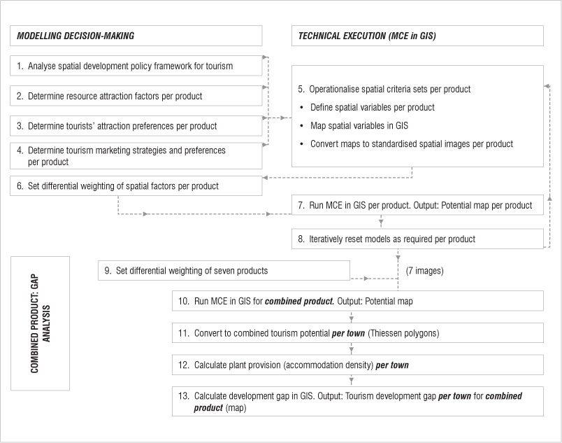
Figure 1: Flowchart of procedures for multiple criteria evaluation (MCE) and gap analysis using a geographical information system (GIS).